Water Platform.
GIS Viewer
Live demo(live Q4/25)
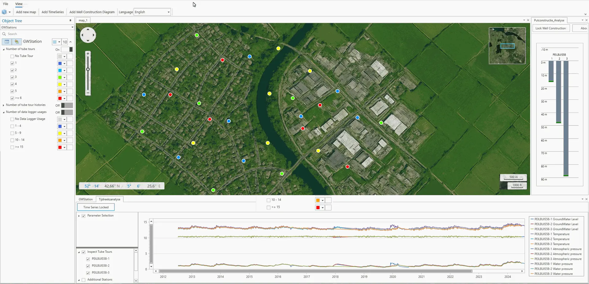
With GIS Viewer, all measurement points from, for example, a Dawaco database are conveniently displayed on an interactive map.

Live demo(live Q4/25)
With GIS Viewer, all measurement points from, for example, a Dawaco database are conveniently displayed on an interactive map.
Live demo(live Q4/25)
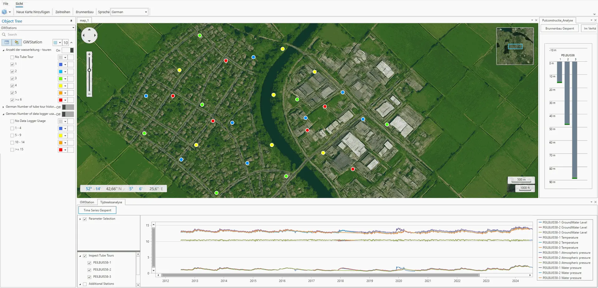
Mit dem GIS-Viewer werden alle Messpunkte, z.B. aus einer Dawaco-Datenbank, bequem auf einer interaktiven Karte dargestellt.
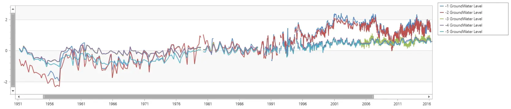
Water levels
The viewer offers plenty of flexibility: the screen is fully customisable, several queries are available by default, and users can easily set up and save their own queries and layouts.
This powerful combination of ease of use and information richness makes the Water Platform GIS Viewer one of the most versatile solutions available on the market today.
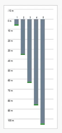
Well structures
Bore hole selection
Queries
The benefits
Information wealth
- Monitoring points, well structures and water levels can be shown.
Flexibility
- The screen can be flexibly arranged with multiple map sheets.
- Various components can be placed freely.
- User-defined layouts can be saved.
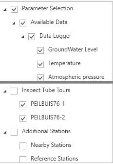
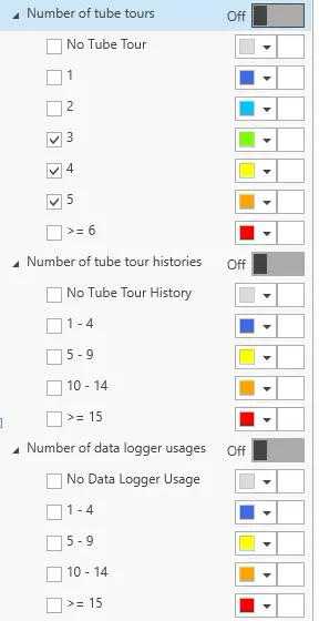
"Infinite" number of filter options
- The new GIS viewer supports "infinite" query capabilities.
- Filter by water level, by number of filter tubes, by number of data loggers.
- Own queries can be saved.
Want to get more out of your Dawaco or Groundwater Office database?
Get in touch for a free demo!
+31 345 - 342170 | info@dawaco.nl